
What We Have Learned So Far: The Early Agricultural Period in Southern Arizona
Desert Archaeology project directors Homer Thiel and Gregory Whitney bring us up to speed on the current archaeological understanding of the ancient peoples who first grew crops in southern Arizona, centuries before the introduction of pottery and the development of the Hohokam culture.
The Early Agricultural period is the time span when agriculture was introduced into the Sonoran Desert and the greater American Southwest, including the Colorado Plateau and the western Chihuahuan desert. Around 2100 BC, either maize (corn) seeds were traded north from what is now Mexico, or persons moved into the region bringing both maize seeds and the knowledge of how to grow this crop.
Archaeologists working in southern Arizona have divided the period into three phases based on changes in material culture and other factors: the Silverbell interval (2100-1200 BC), the San Pedro phase (1200-800 BC), and the Cienega phase (800 BC-AD 50).
Early Discoveries
Archaeologists understood by the early 20th century that people lived in the American Southwest prior to the introduction of pottery. E. B. Sayles and Emil Haury of the Gila Pueblo Archaeological Foundation began to search for evidence in arroyos in southeastern Arizona. By the 1940s they defined the Cochise Culture to describe the lifeways of these early inhabitants. Although this work took place prior to the invention of radiocarbon dating, Sayles and Haury divided the Cochise Culture into three temporal phases or stages, naming the most recent the San Pedro stage. Excavations at the Matty Canyon, 30 miles southeast of Tucson in the Cienega Creek Valley, in 1955 led to the first radiocarbon dates for the San Pedro stage. Other sites in the Cienega Creek area were explored by Bruce Huckell in 1983.
From 1984 through 1993, Bruce and Lisa Huckell investigated a site along Tanque Verde Road in the eastern Tucson Basin. On the surface they found a scatter of flaked stone and ground stone artifacts. Later testing revealed pits and pit structures containing burned maize cobs that were radiocarbon dated to the San Pedro phase. The Cochise Culture concept was now updated as the Early Agricultural period.
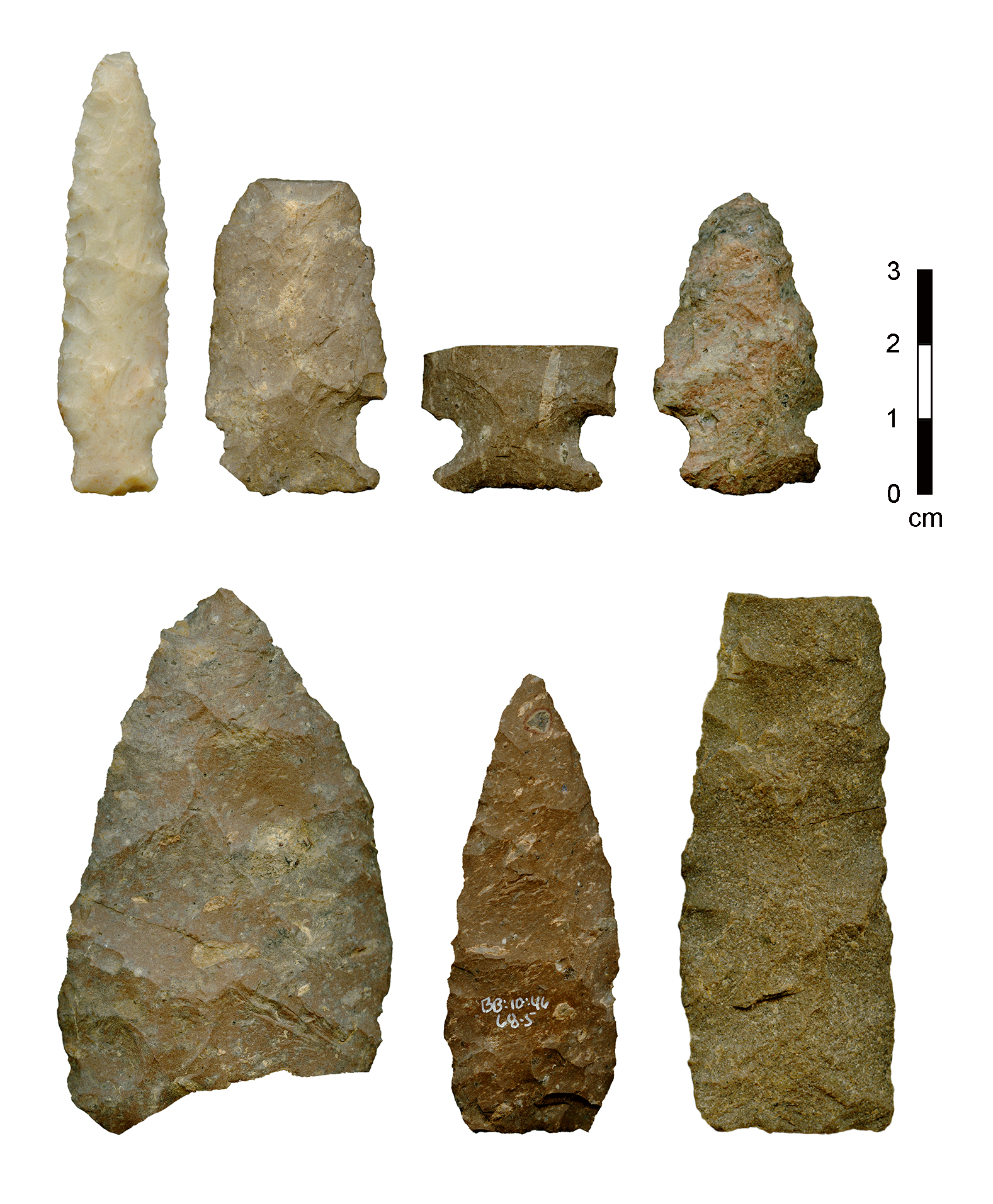
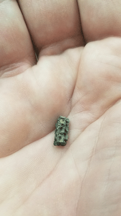
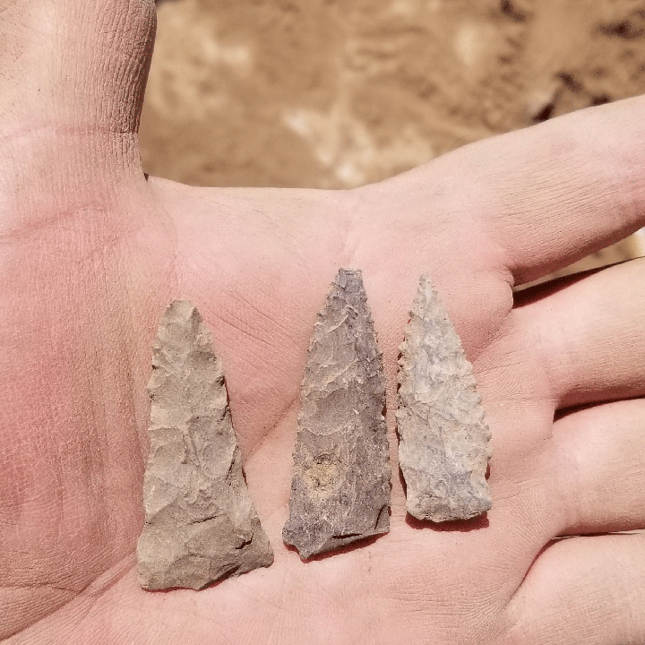
San Pedro phase projectile points and bifaces from the Milagro site (photo by RJ Sliva).
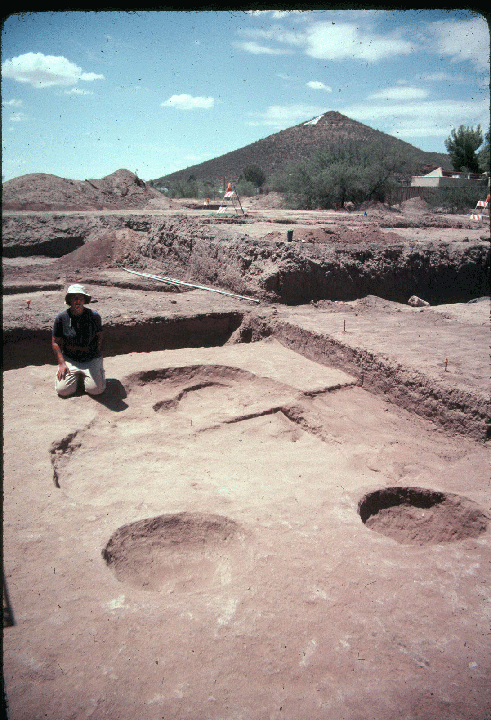
In 1993, Desert Archaeology received the contract to conduct archaeological investigations along Interstate 10 in Tucson, between Ina Road and 22nd Street, prior to the construction of new frontage roads and other improvements. On the west side of Interstate 10, near the Miracle Mile exit, backhoe trenches revealed pit structures and pits that contained cultural materials but lacked ceramics. Radiocarbon dates revealed the features predated the widespread usage of ceramics. Subsequent mechanical stripping of the area (by Dan Arnit of Innovative Excavating) uncovered numerous pit structures and pits, along with an oversized “big house” structure. This was Arnit’s first project utilizing precision backhoe excavation with his custom-built 7-foot-wide blade, allowing large areas to be carefully uncovered.
In the years since, many construction projects along the Santa Cruz River have led to extensive archaeological projects at a number of sites including Las Capas, Los Pozos, the Dairy Site, the Home Depot Site, the Sweetwater Site, the Clearwater Site. This work has provided a better understanding of the Early Agricultural period, including defining the times that preceded and follow the San Pedro phase: the Silverbell interval and the Cienega phase.
The Silverbell Interval (2100-1200 BC)
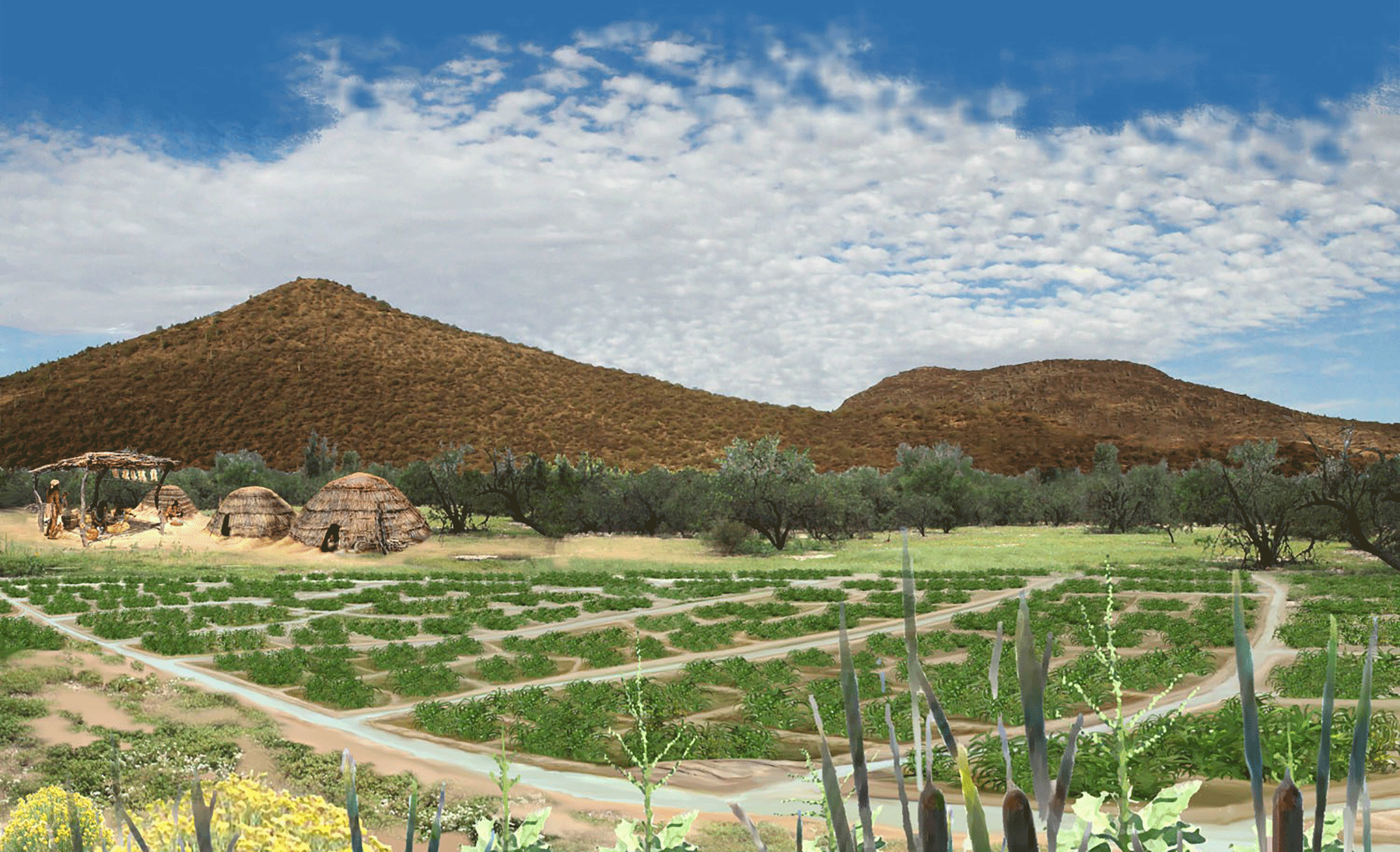
The Silverbell interval saw the arrival of maize agriculture and the first irrigation ditches in the Tucson Basin along the Santa Cruz River. Sites from this timespan are deeply buried by sediments deposited during river flooding, from two to five meters below the modern ground surface. Features dating to the Silverbell interval have been identified at the Clearwater Site, Las Capas, Los Pozos, and the Home Depot Site.
What have we learned? At the Clearwater Site a few shallow depressions appear to be ephemeral pit structures, probably used for a short period of time during the planting of maize, work in the fields, and harvesting the crop. Nearby were roasting pits, where food was cooked or rocks heated for stone boiling in leather bags or waterproof baskets. The first irrigation ditches were dug during this time, carrying water from the Santa Cruz River to nearby fields.
Sarah Dahlen provides scale for a Silverbell interval structure found at the Congress Street locus of the Clearwater Site (photograph by Jonathan Mabry).
The San Pedro Phase (1200-800 BC)
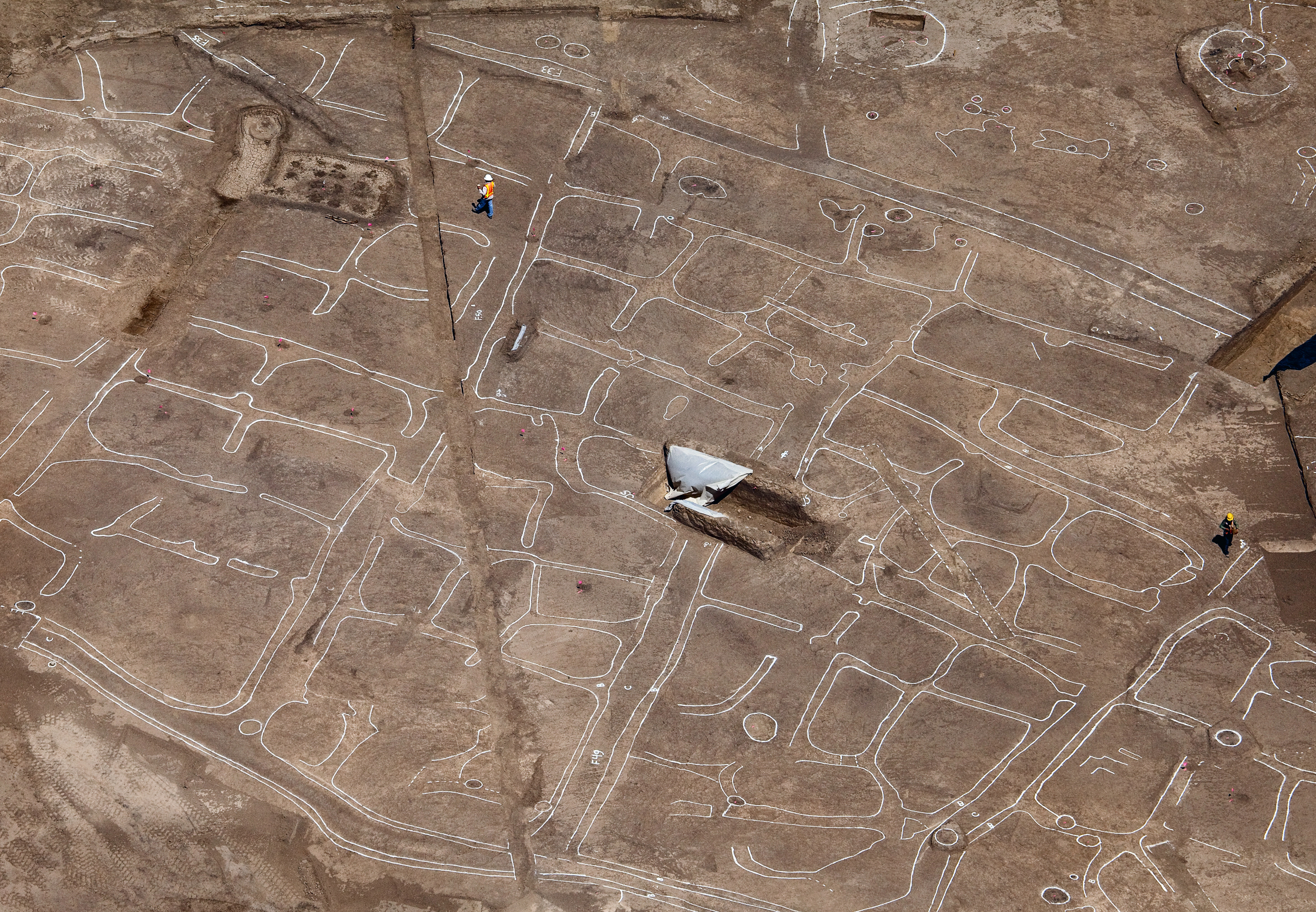
Maize agriculture intensified during the San Pedro phase. Work at the Las Capas site, near West Ina Road and Interstate 10, revealed layers of large agricultural fields consisting of small, depressed field plots that were irrigated with a series of small ditches running off from larger canals. The fields were visible because the organic material used as fertilizer left them darker than the surrounding sterile soil. In some cases, individual planting pits could be identified within the plots. Numerous large pits were located near the fields. These may have been storage pits for the harvested maize, and were also used to store ground stone tools—used for processing maize stalks, kernels, and cobs —when people were away from the site. The damp conditions and frequent flooding of the fields suggest that maize was stored in the pits only temporarily.
Aerial view of an early field system documented at the site of Las Capas, Tucson, Arizona (photo by Henry Wallace).
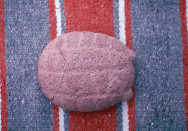
A partial San Pedro phase maize cob found at the Las Capas site.
We identified several pit structures at the edge of one of the field areas at Las Capas. They were oval or round in shape, with postholes for the posts that formed the walls and held up the roof. Some had extending entryways. Many had storage pits and hearths.
Maize formed a small portion of the diet during the San Pedro phase. Instead, wild foods accounted for the majority of plants people consumed. People gathered plants including purslane, sunflower, pigweed, and goosefoot for their edible leaves and seeds. They also ate mesquite seeds and pods, cactus fruits and pads, and walnuts. The farmers almost certainly hunted the small animals that were drawn to their fields. Cottontails, jackrabbits, and rodents were the most important meat sources. Deer, and to a lesser extent antelope and bighorn sheep, were also hunted, either in the Tucson Basin or up in the nearby mountains. People then used the bones from these larger mammals to make tools such as awls.
Faunal bone recovered from Las Capas, most of which is jackrabbit or cottontail.
The presence of spindle whorls reveals that San Pedro phase people were spinning fibers into thread, perhaps to make cloth, rope, or for other purposes.
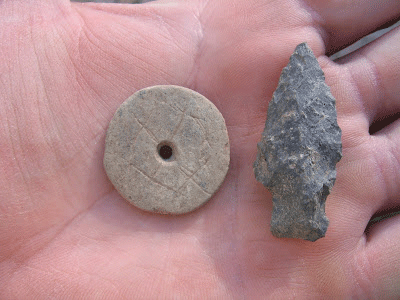
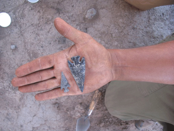
A stone spindle whorl and a San Pedro point from the Las Capas site.
Fired clay figurines have been found at some sites. These could have been used for ceremonies involving ancestor worship, to induce rainfall, or to ensure a good harvest.
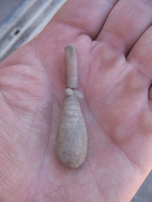
A female figurine from Las Capas.
Shell jewelry and non-local stone used to manufacture tools indicate that Las Capas residents engaged in long-distance trade. The lack of shell manufacturing debris at the site suggests that finished jewelry pieces were being passed eastward from one community to another, or perhaps that people from the Tucson Basin were traveling westward some distance to obtain the items. High quality obsidian stone cores may have arrived in Tucson the same way, or persons from Tucson may have traveled to distant quarries to obtain materials.
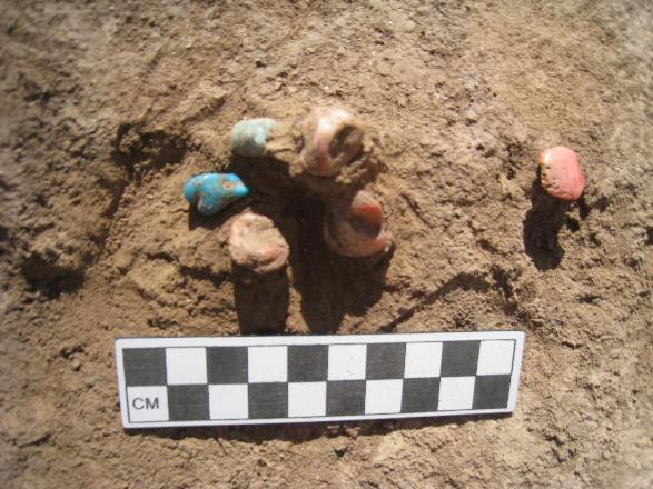
San Pedro phase beads as they were found in an agricultural field berm at Las Capas,.
Mortuary features from this timespan are typically scattered throughout sites. At Las Capas, evidence for interpersonal violence was indicated by individuals with spear points and bone awls inside their bodies. It appears that a raiding party had attacked the community, perhaps in search of stored maize.
A biface and two Empire points found in a San Pedro phase feature at Las Capas (photograph by Homer Thiel).
The Cienega Phase (800 BC-AD 50)
The Cienega phase saw the growth of villages, some with dozens of pit structures, although not all structures were in use at the same time. Pit structures were almost always circular with a ring of post holes. Many had small hearths that were offset toward the edges of the house, which provided heat and light to the occupants but also may have led to many houses burning. The charred remnants of these structures reveal to archaeologists how they were built. Many of the houses were remodeled during their uselives and were sometimes enlarged, indicating longer occupation and perhaps increased family size.
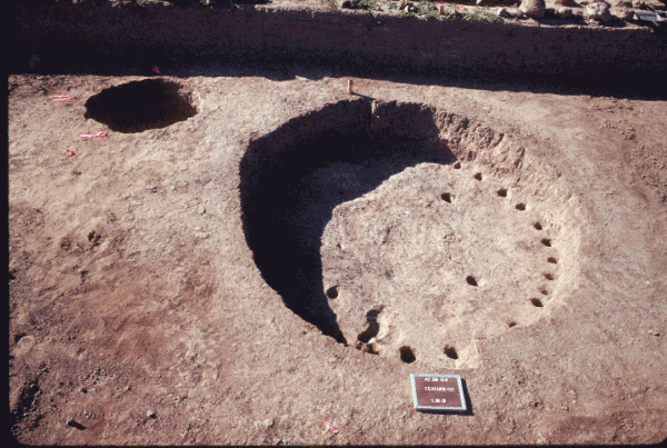
A Cienega phase pit structure at the Mission locus of the Clearwater Site (photo by Gregory Whitney).
Architectural specialization is evident in Cienega phase settlements, with some structures used as dwellings and some with large central pits used for storage. Each major settlement had at least one “big house,” a structure much larger than the others that may have been used for ritual activities. Stone trays found in some structures may have been used for ceremonies.
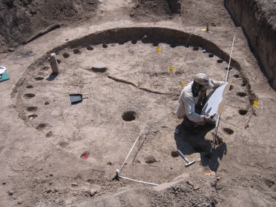
Allen Denoyer mapping a “big house” found at the Mission Garden locus of the Clearwater Site (photo by Homer Thiel).
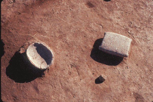
Stone trays found in a Cienega phase structure at the Mission locus of the Clearwater Site (photograph by Gregory Whitney).
The bottom of one tray may have been carved to look like a turtle or tortoise (photograph by Homer Thiel).
The increased number of pit structures suggests that settlements were becoming more permanent. This is also indicated by the presence of formal cemeteries at three sites. The cemeteries have numerous individuals interred within a small space. In some cases, persons who had died elsewhere were exhumed and their remains brought back to the village to be re-interred. This may be an indication that people were making formal claims on land, the cemeteries serving as a physical marker stating to outsiders that the village and surrounding fields were under the ownership of a group.
Cienega phase dart points found at the Mission locus of the Clearwater Site (photograph by Homer Thiel).
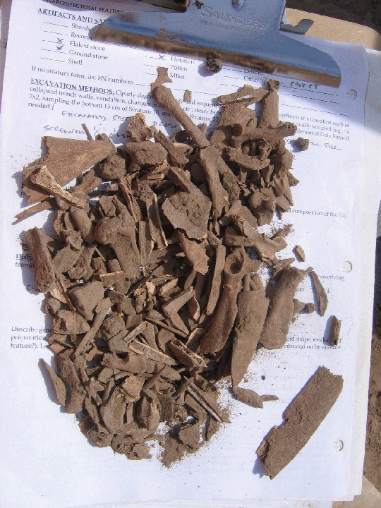
Open-air sites are not conducive to the preservation of perishable materials made from plant fibers, wood, and animal skins and hides. It is very likely that the homes of the Early Agricultural people contained baskets, wooden bowls and trays, digging sticks, tanned hides, ropes made from agave fibers, and woven mats. The evidence that they had these come from the wear patterns found on ground stone and bone tools, showing they were used to process plants, wood, and hides.
What Happened Next?
Around AD 50, people across the Southwest began to make what archaeologists call seed jars, which are large pottery vessels that were useful for storing seeds and other foods because they protected the contents better than baskets and hide bags. Eventually other specialized vessel forms were made for cooking and serving meals. People began to experiment with architecture, building new types of houses. The Early Ceramic people also began to grow new crops: beans, squashes, and cotton. All of these changes would lead to the later culture that archaeologists have named Hohokam (or Huhugam).
Each project we undertake near the waterways of the Tucson Basin will add to the understanding of how the first farmers in the American Southwest interacted with their environment and with each other to sustain themselves and build communities.