Desert Archaeology Cartography & the UAV Photogrammetry Revolution
This week’s blog is by Mike Brack, Desert Archaeology’s mapping director and licensed UAV airman.
I am fascinated with the technological change I have witnessed over a 25-year career of archaeology, cartography, and land surveying. From plane table and alidade to transit to electronic total station to the modern standard of precision GPS surveying systems, innovation continually enables me to do my work faster, better, and cheaper. Archaeological mapping in my early years is barely comparable to the technology at my disposal today. I have seen a 600 percent gain in person-hour productivity, accuracy rising from meters to decimeters to centimeters, and a 100-fold increase in the “density” of the mapping data. The latest tool in my bag of surveying technology takes speed, quality and efficiency to the next new level—400 feet in the air, to be exact.
“Drones,” or, more technically, small uncrewed aerial vehicles (UAVs), are revolutionizing the way I do archaeological mapping. UAVs move the surveying measurement from a person on the ground to an automated airborne camera. This technology is another leap beyond in productivity, precision, and data acquisition, and it further expands the suite of mapping products and analyses I can derive from the data. UAV mapping melds rigorous principles of land surveying and photogrammetry with a small, remote controlled aircraft. The obvious product of a camera mounted on an aircraft is aerial photographs—a view from above, but the data run deeper than just pretty pictures.
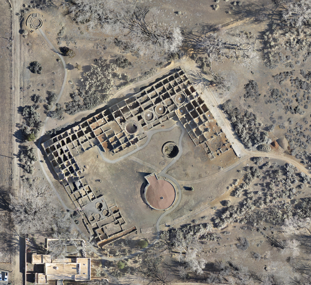
Aerial view of the West Ruin architecture, Aztec Ruins National Monument (by Michael Brack).
Aerial images are stitched into a seamless photo mosaic that is precisely orthorectified in all three dimensions using standard land surveying methods. The process is more than photography; it is photogrammetry—metric photographs. The changing perspective of the moving, airborne camera captures overlapping images that can be processed into a photorealistic 3D model of the landscape. The “metrics” of this model are used to derive DTMs (digital terrain models) showing the height of vegetation and DEMs (digital elevation models) showing the ground elevation, which can be further used to generate topographic contours for 2D visualization. The suite of imagery and metric data is the basis for further quantitative analysis like area and volumetrics, slope and erosion, or drainage networks and hydrology. These models can feed into more qualitative assessments of past and present land uses, vegetation, geomorphology, and archaeological site condition and stability. When the element of time is added, airborne photogrammetry becomes a powerful tool for understanding environmental and landscape change, archaeological site health, and land use over a duration of sequential UAV flights.
The principles of airborne photogrammetry have changed little, but UAV technology makes the approach accessible for routine, if not casual, use in archaeology. The UAV imagery, topographic data, and derivative landscape studies remain unchanged from crewed-aircraft, film-based photogrammetry, but can be developed at a small fraction of the cost of the traditional engineering approaches. Archaeologists have long been fond of aerial photography and topography, but access to high-quality data is painfully infrequent, and the acquisition of new data has been cost prohibitive prior to the drone revolution. Modern UAV equipment, methods, and techniques put robust, precise engineering and cultural resources data in the hands of archaeologists rapidly, reliably, and cost effectively.
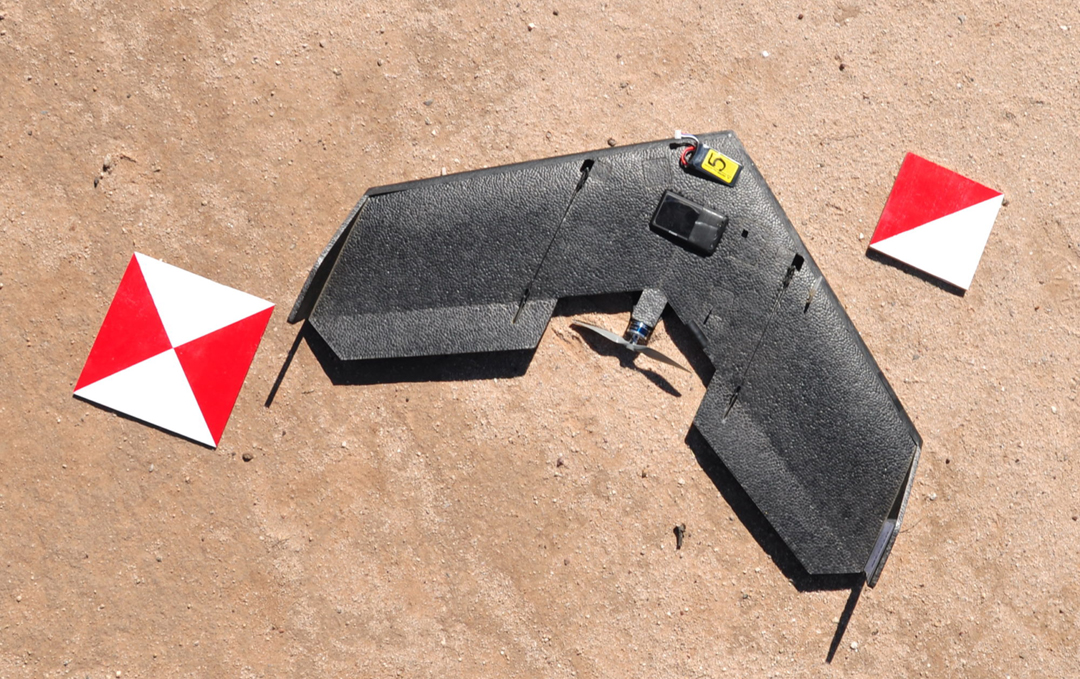
Another successful drone launch (image courtesy of Lewis Borck).
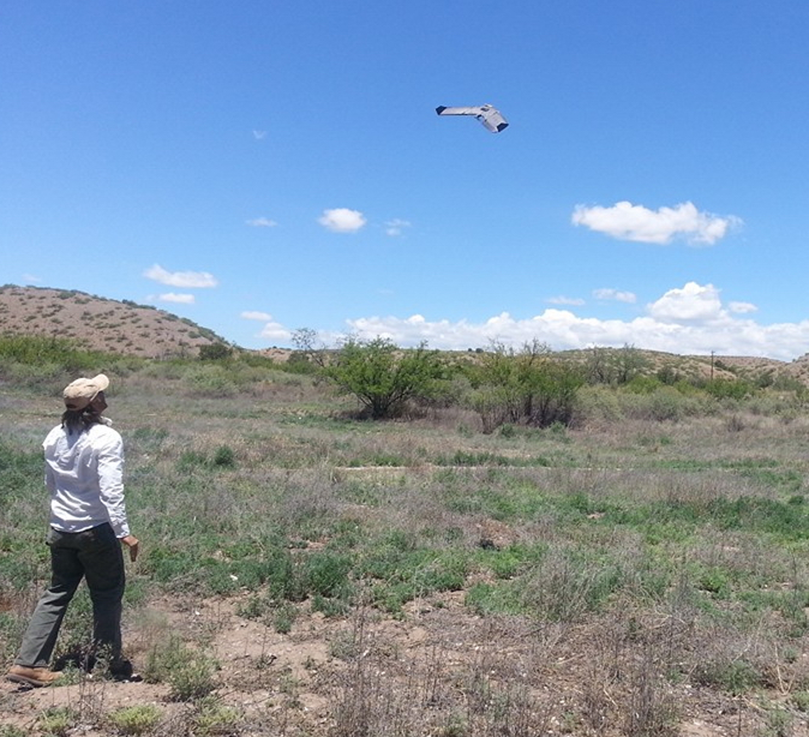
Since 2012, Desert Archaeology has flown a fully autonomous, fixed-wing UAV aircraft with an automated digital camera system optimized for airborne cartography. In addition to integrated flight and camera controls, avionics include GPS, compass, barometric altimeter, and 3-axis orientation sensor. The hand-launched and glide-landed vehicle has a 30-minute flight time and an operational radius of three quarters of a mile. With sequential launches and recoveries, the battery-powered plane can be kept in the air almost continuously during flight operations with the combined ground coverage ranging from square meters to tens of square kilometers. Effective working altitudes of 30-120 m produce digital images with a final ground resolution of 1.5 to 6 cm per pixel. Using sub-centimeter GPS to establish ground control for the UAV missions, horizontal and vertical errors are under 2-3 cm, which meets any comparable approaches. Depending on the flight parameters, contour mapping meets National Mapping Standards at intervals as small as 10 cm. I am a FAA certified remote airman, and flight missions comply with Part 107 of the Federal Aviation Regulations governing commercial UAV use.
The application of the UAV is as infinite as creativity, curiosity, and the questions that guide us. Standard site recording techniques are complemented with high-resolution imagery and topography to understand organizational structure and architectural arrangements. Commonly, the analysis of the remote airborne data leads to the recognition of cultural features, like subtle mounds, other earthworks, or buried architecture, that are not obvious from an on-the-ground perspective. For data recovery projects, the drone develops comprehensive pre-field engineering data to inform and guide the archaeological excavations. The UAV can be flown sequentially during a project to generate a continuous photographic and topographic record of the excavation and archaeology, and at the close of archaeological work, the final airborne data can be used by clients, engineers, and architects so they have a complete understanding of current conditions and disturbances at their project site.
UAV mapping applications extend beyond what is normally conceptualized as “archaeology” in to the domain of what I call “archaeo-engineering.” The UAV provides baseline data from which engineering designs can be developed that address site stabilization, drainage improvements, or preservation by reburial. The final broad category of UAV use relates to the preservation of important archaeological sites. The drone is a valuable tool for assessing and monitoring the long-term health and stability of cultural resources. Quantitative and qualitative data derived from the UAV allows archaeologists to understand the condition of sites, potential threats to preservation, and, importantly, with incremental UAV flights over time, changes in site health and stability.

Colorful badlands of Petrified Forest National Park (by Michael Brack).
The drone revolution is far more than a passing infatuation with a new gadget. Small UAV airborne technology is a new standard for data collection for archaeologists and cartographers, and further innovation will continue into the future. It is another powerful, flexible remote sensing and land surveying tool that I have added to my already deep bag of measurement tricks. With the cliché originating at Apollo-era NASA of the 1960s, as a young engineering student, I learned the mantra of “faster, better, cheaper—choose two” as a nearly universal engineering constraint. The UAV is a rare condition where all three engineering criteria are met. Drones are unmatched at speed, quality/precision, and cost effectiveness, but we still should not overlook the appeal of just a pretty picture.
GALLERY: UAV PHOTOS AND ARCHAEOLOGICAL APPLICATIONS
Following are examples of photographs and maps produced by Desert Archaeology’s mapping specialists, using data collected through UAV aerial photography. Visit our Graphics, Mapping, and Cartography page to learn about the range of services we offer our clients.
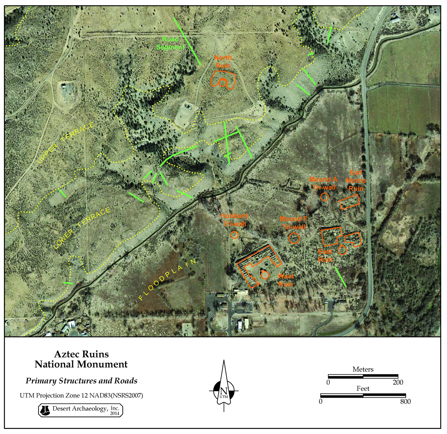
Overview of Aztec Ruins National Monument showing the relationship between archaeology, physiography, and the modern built environment (by Michael Brack).

Topography of the East Ruin great kiva, Aztec Ruins National Monument (by Michael Brack).
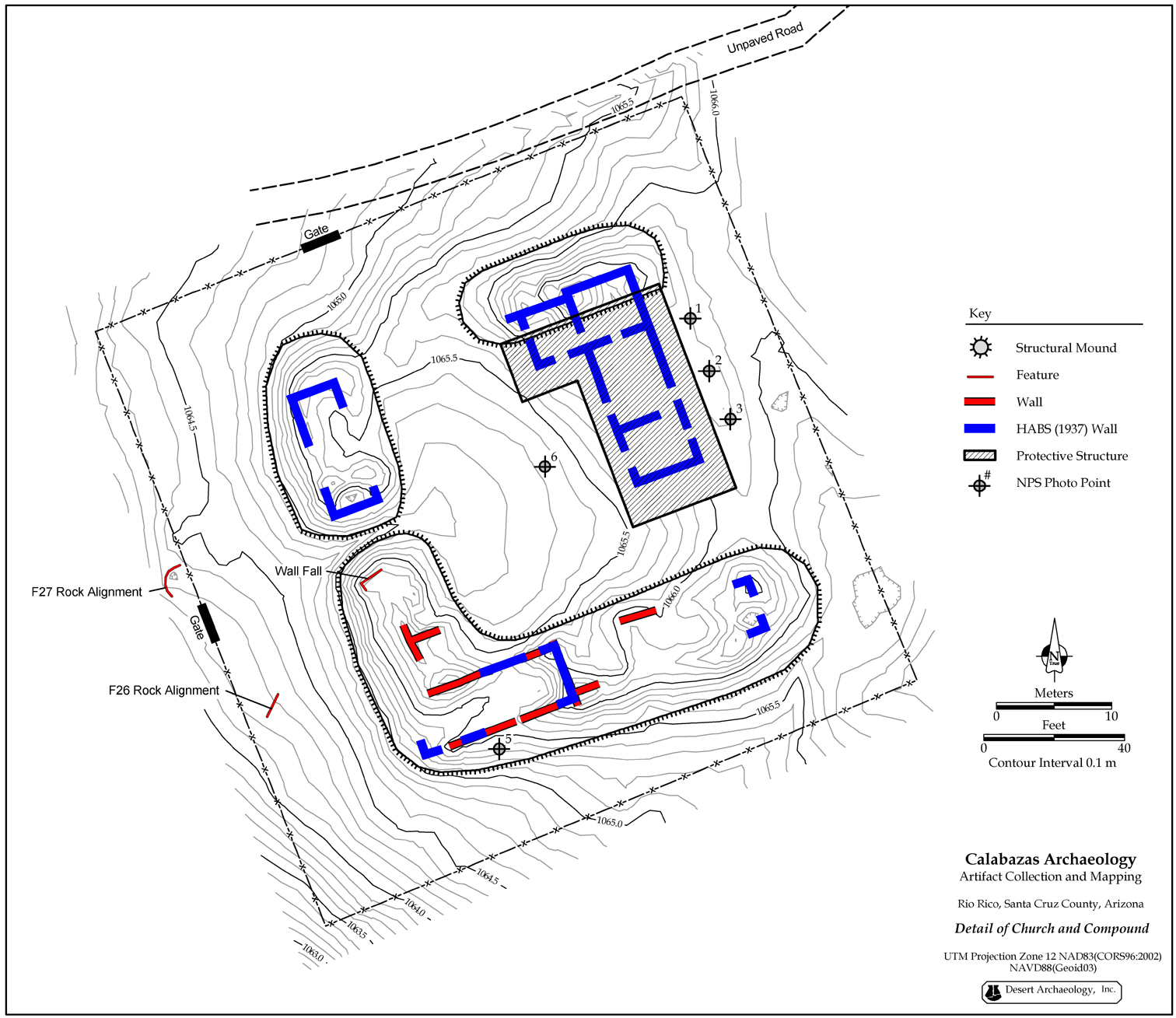
Detailed map of adobe ruins of the visicita, San Cayetano de Calabazas, Tumacácori National Historical Park (by Michael Brack, cartography by Tyler Theriot).
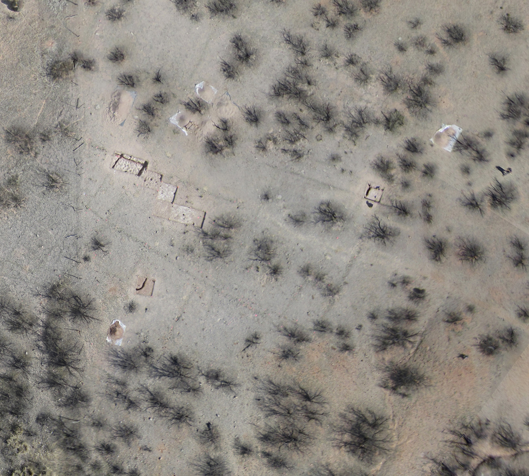
Aerial photography showing a buried, Spanish-period stock pen in the vegetation as a brigadoon effect, Mission los Santos Angeles de Guevavi, Tumacácori National Historical Park (by Michael Brack).
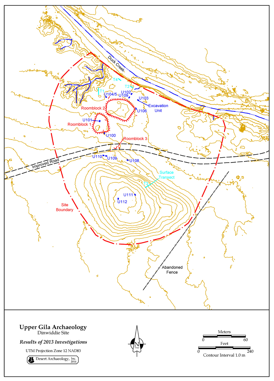
Archaeology and topography of the Dinwiddie site, Gila County, New Mexico (by Michael Brack).

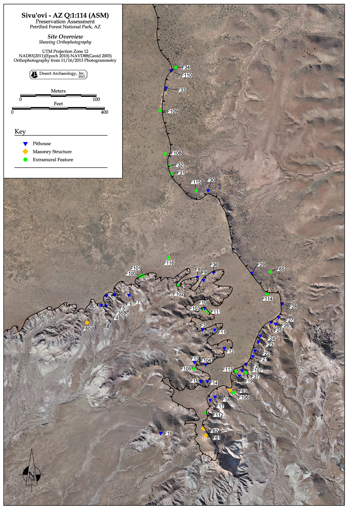
Topography and hydrology of the Basketmaker site of Sivu’ovi, Petrified Forest National Park, illustrating the relationship of exposed archaeology and erosion (by Michael Brack).
Aerial photograph illustrating the landscape and archaeology at Sivu’ovi, Petrified National Forest National Park (by Michael Brack).

A bird’s eye view of the Los Pozos site, Pima County, Arizona, showing excavations and distribution of Early Agricultural period pit features (by Michael Brack).
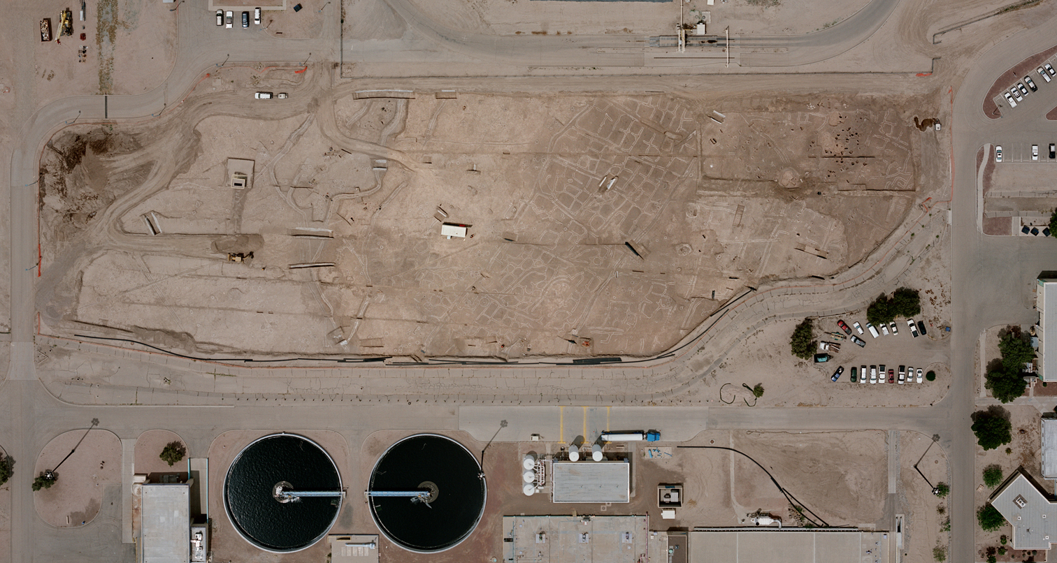
An aerial overview of extensive excavations at Las Capas, Pima County, Arizona, showing an Early Agricultural period canal and field system (by Michael Brack).
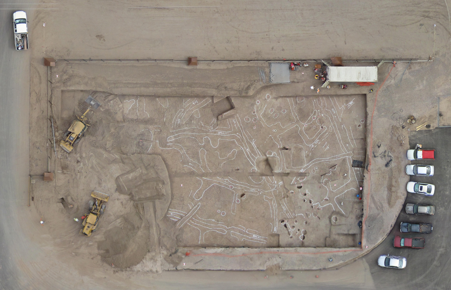
UAV photograph documenting ongoing excavations at Las Capas, Pima County, Arizona (by Michael Brack).
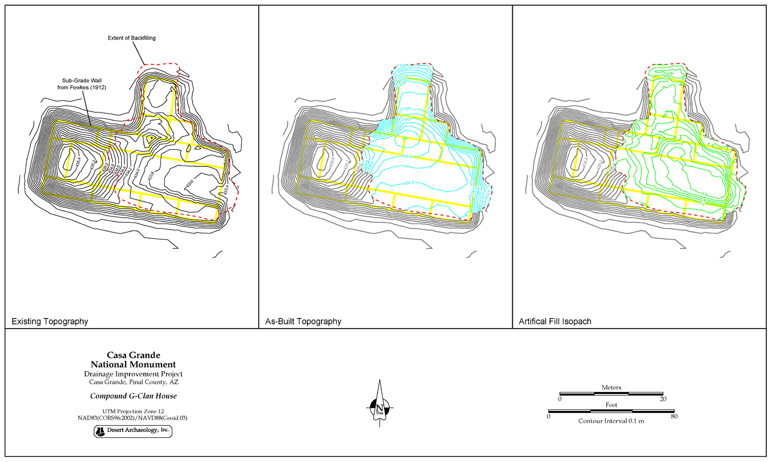
An illustrated summary of engineered stabilization at Compound G, Casa Grande Ruins National Monument (by Michael Brack).
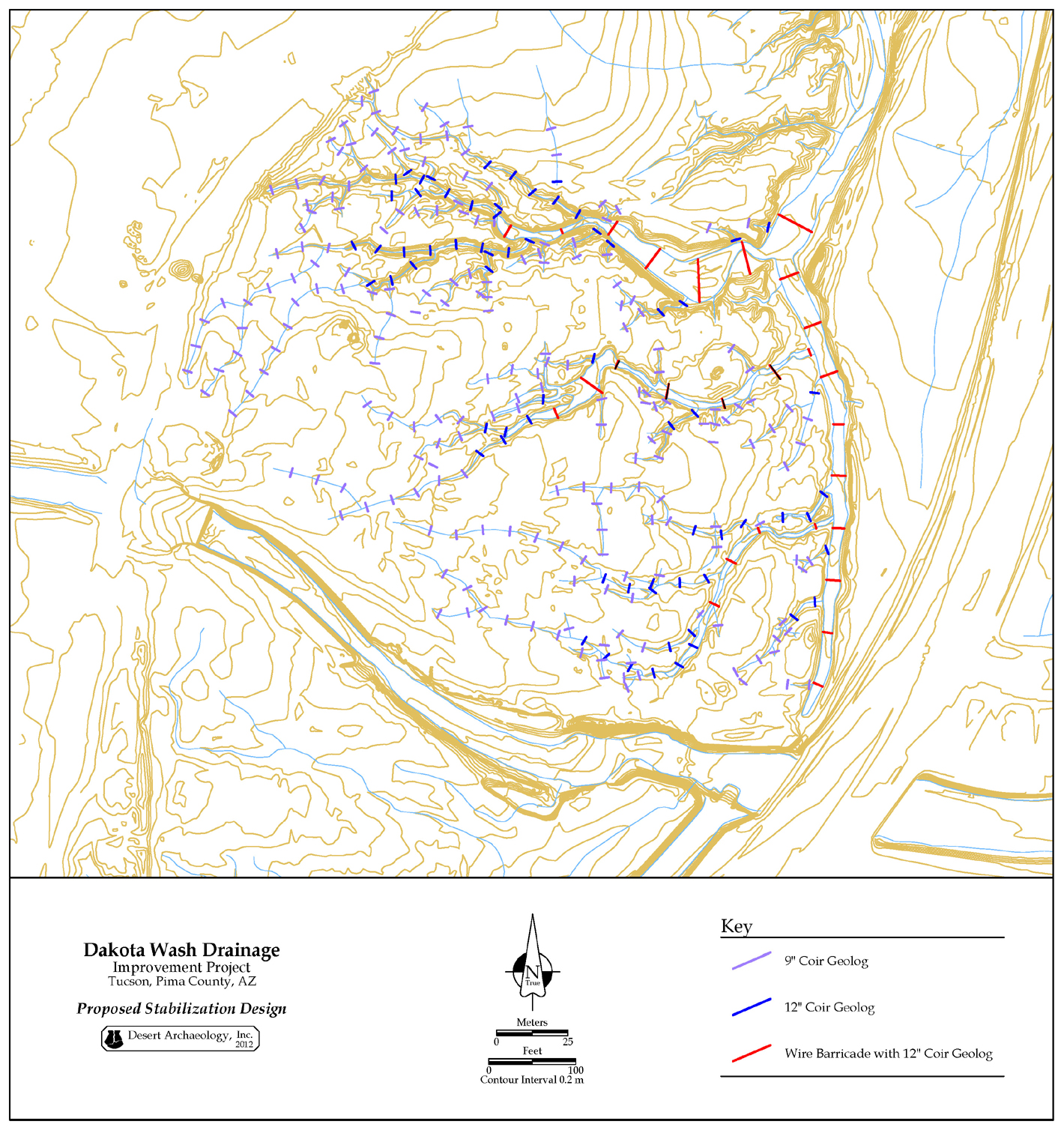
Drainage stabilization design for the Dakota Wash site, Pima County, Arizona (by Michael Brack).

UAV aerial photography documenting the current conditions of the Yuma Wash site archaeological preserve, Pima County, Arizona (by Michael Brack).