The Hohokam of Fort Lowell: The Hardy Site
Homer Thiel talks about the Hardy Site and what the structures and artifacts recorded there teach us about Hohokam lifeways in the eastern Tucson Basin.
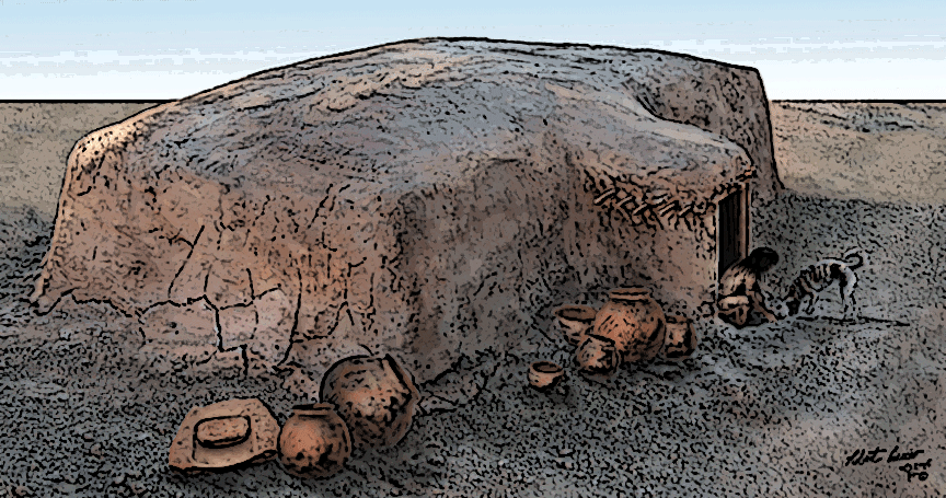
The word Hohokam refers to the archaeological culture that existed in the Sonoran Desert from about AD 500 to 1450. The Hohokam are well known for their beautiful painted pottery, elaborate projectile points, carved stone and shell items, ballcourts, and platform mounds. Hundreds of Hohokam archaeological sites have been examined by archaeologists, and when combined with oral histories of descendant Pima and O’odham people, a better understanding of the lives of these Ancestral Native Americans has been developed.
One of the major Hohokam sites in the Tucson is the Hardy Site, located at Fort Lowell, a military fortress that was established in 1873 a few miles northeast of downtown Tucson. It is likely that the soldiers who built the fort noticed artifacts scattered about the ground. Adolf Bandelier (1840-1914), one of the earliest ethnologists and archaeologists in the American Southwest, visited Fort Lowell in 1884 and noted the presence of a prehistoric trash mound in the fort’s Parade Ground.
The soldiers marched away in 1893 and Fort Lowell eventually became a park. In the mid-1970s, the Arizona State Museum conducted excavations in a relatively small area and encountered nine pit structures, soil mining pits (where the Hohokam dug up soil and caliche for roofing and wall adobe and plaster), and roasting pits where food was cooked. The houses were built on top of each other, indicative of an intensive re-use of the area between AD 650 and 1300.
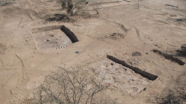
In 2012 Desert Archaeology was tasked with helping to remove contaminated soil from the Adkins Steel property near the park, on the west side of North Craycroft Road. The Adkins family had operated a steel tank manufacturing business on the property from the 1930s to the early 2000s, leaving behind spilled oil and metal shavings that needed to be removed. Dan Arnit of Innovative Excavating carefully stripped away the contaminated soil with a backhoe to be hauled away in large roll-off containers. He also removed several septic tanks. Beneath these stripped areas were many Hohokam features.
We excavated 10 Hohokam pit structures. They ranged in date from the Middle Rincon phase (AD 1000-1100) to the start of the Tanque Verde phase (AD 1150-1300). What were they like?
Feature 130, Middle Rincon 2 or 3 phase pit structure, AD 1040-1080
The people building Feature 130 dug a large pit and then set posts inside the pit to form the walls of the house. The profusion of postholes suggests extensive remodeling occurred. A trench around the inside of the posthole alignment probably allowed woven mats hanging from the walls to be tucked into the floor, reducing drafts. Two large posts in the floor of the house supported a roof beam. The house had a usable floor area of 18.68 square meters (201 square feet). The entranceway and the area around the fire hearth were coated with plaster, while the rest of the floor was polished caliche.
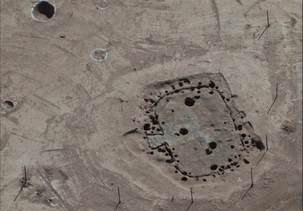
An aerial photograph of Feature 130 showing the many postholes and the wall trench. Photograph by Henry Wallace.
The house burned and the occupants left behind two ceramic vessels and 11 pieces of ground stone on the floor. A metate and a mano rested on the floor in the southwestern quarter of the house, along with a polisher and an upside-down mortar with red ochre pigment inside it—clear evidence that the inhabitants of the house were manufacturing pottery.
Feature 134, Middle Rincon 3 to Late Rincon phase, AD 1080-1100
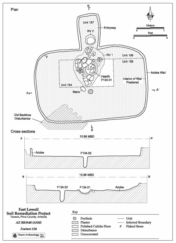
Feature 134 was at the northern end of the Adkins property, its ramped entryway pointing to the north. The walls were plastered, as was the fire hearth. The floor was polished caliche with a usable area of 10.69 square meters (115 square feet). A large plainware jar lay on top of the hearth, and a Middle Rincon Red-on-brown bowl lay in the entryway on top of a layer of roof fall, indicating it may have been on the roof of the structure when it collapsed. A mano was on the floor next to a single posthole that once contained the post that held up the roof. The structure was heavily burned and was probably purposely set on fire.
Feature 157, Transitional Middle Rincon 3 to Late Rincon phase pit structure, AD 1080-1150
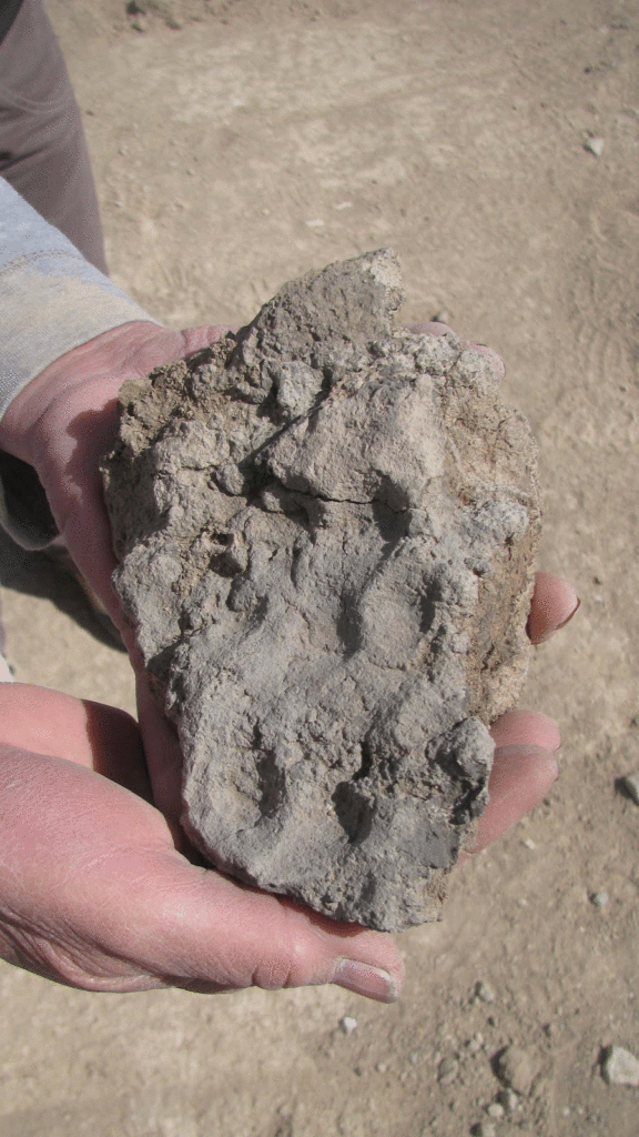
This house was the westernmost on the Adkins property, encountered while removing a septic tank. The house had a polished caliche floor with a usable area of 18.94 square meters (204 square feet). The walls were plastered. A pestle, two manos, and a large decorated sherd lay on the floor. The house was burned when it was abandoned, the fire hardening and preserving the roof and wall material.
Features 160 and 164, Late Rincon to Tanque Verde phase pit structures, AD 1100-1300
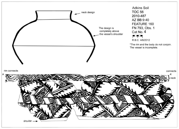
At the south end of the stripped area were a pair of pit structures, obviously used at the same time. Feature 160, the eastern structure, was a rectangular house with a polished caliche floor area of 16.03 square meters (172.5 square feet). A stepped entryway pointed to the north. The walls were made from eight cm of adobe covered with one cm of plaster. The house had burned, firing some of the 9-cm-thick roof and wall material. Several artifacts were left on the floor, including 10 ground stone artifacts, a modeled ceramic spindle whorl, two pieces of mica, and pieces of several ceramic vessels, one of which was a Tanque Verde Red-on-brown jar.
Next door, to the west, was Feature 164, a storage building where craft activities took place. No hearth was present, indicating that the building was not a dwelling. This rectangular structure had a floor area of 9.18 square meters (99 square feet). The walls were made from thick adobe covered inside with a thin layer of plaster. The burned daub roofing and wall material that had collapsed into the house revealed that reeds, saguaro ribs, and wood beams were used in the construction of the building. The floor was smoothed caliche, with several depressions that allowed round-bottomed bowls and jars to sit upright.
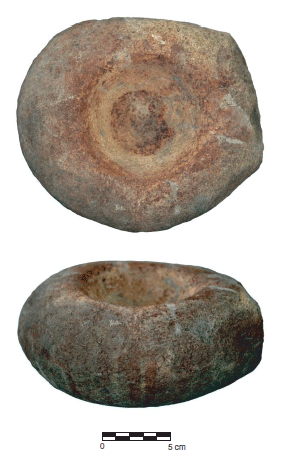
Fragments from a large plainware olla were scattered across the floor. Many pieces of flaked stone revealed that someone had been making tools inside the room. A very interesting artifact was a stone used as a painter’s palette.
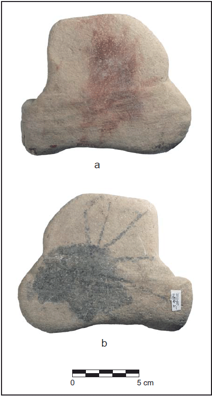
Red and black pigment on the painter’s palette. On the side with black pigment you can see where the painter’s brush was dragged out to reduce the paint load.
What did we learn?
It seems likely the Adkins property is close to the edge of the Hardy site, unlike the area on the east side of North Craycroft Road that was excavated in the 1970s, where pit structures were built on top of each other. Plotting the dates of the structures and a trash mound reveals that the Hohokam residents of the site moved from the middle of the property to the north and then back to the south through time.
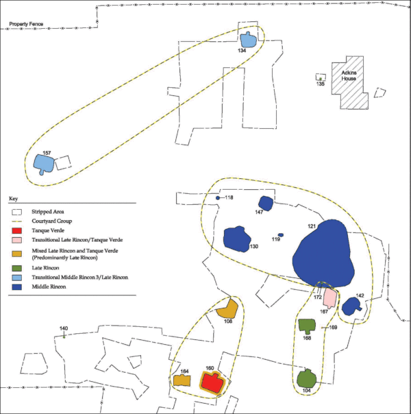
Map showing the dates of features at the Adkins property portion of Hardy Site. Dark blue is earliest, then light blue, then green, with yellow-pink-red features the latest.
Evidence from floor artifacts shows that the people who lived here manufactured pottery vessels and stone tools, and processed red ochre pigment inside their structures. Pieces of Mimbres pottery were unexpected artifacts that indicate trade took place between Hardy Site residents and people living in what is now western New Mexico.
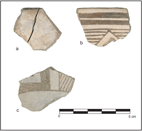
Mimbres sherds dating from about AD 1060 to 1110.
Only about 13 percent of the Adkins property was stripped, and the rest of the area almost certainly contains dozens of additional Ancestral Native American houses and features. These have been preserved in place under a protective layer of gravel.
This project was funded by Pima County for the City of Tucson.
Resource
The report is available online on the City of Tucson’s Historic Preservation Office website.


